
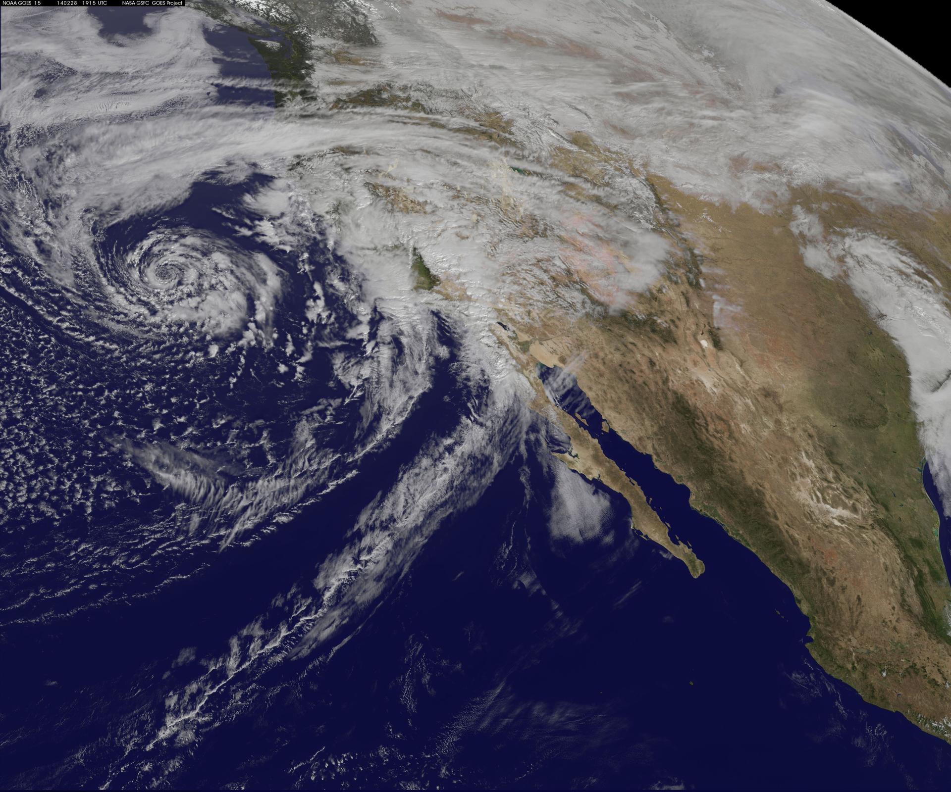
CALIFORNIA — The National Oceanic and Atmospheric Administration stated that this year's El Niño has reached "super" status. A study published in the journal Science found that the current El Niño is likely the strongest in over a millennium.
NOAA stated there is a 75% chance that the October-through-December period will qualify as a historic-strength event, exceeding the strength of previous El Niño events in the modern record dating to 1950. The agency gave El Niño a greater than 90% chance of reaching very strong strength during the Northern Hemisphere fall and winter of 2026-27.
As of September 27, sea surface temperatures in the Niño 3.4 region of the Pacific Ocean were 5.7 degrees Fahrenheit (3.15 degrees Celsius) above average. Estimates show that sea surface temperatures in the Niño 3.4 region could reach 7.2 F (4 C) above average by November. El Niño is expected to peak by early 2027 and persist until at least March.
Daniel Swain, a climate research scientist, warned of severe consequences driven by these metrics. "If you use that overall climate perspective, you get really a more alarming answer from the absolute numbers because they are telling us that later this year into next year we’re going to, almost certainly at this point, see record-breaking global temperatures again," Swain said. He added, "We may see temperatures next year that are close to that 1.7 degree centigrade range, and could even be higher than that."
Coastal regions face immediate threats from the rising waters. "The number one concern I have this winter is for people who live on the coast of California, because this record breaking El Niño will double the amount of sea level rise we’ve seen from climate change overnight," Swain said. He described the phenomenon mechanistically, stating, "El Niño is a recharge oscillator, which is effectively a battery." Swain further noted, "We’re going into extreme territory with this one, probably record breaking."
California Governor Gavin Newsom declared a state of emergency and called in the California National Guard to assist with emergency response. San Diego County officials advised residents to begin preparing for storms expected in the fall and winter, warning of heavy rain, strong winds, mountain snow, and coastal flooding. The county launched an online informational resource called the El Niño 2026 Informational Hub to help residents prepare for the El Niño season. San Diego city crews began installing sand berms on city beaches and the Mission Bay shoreline to prepare for heavy swells and protect against flooding.
U.N. Secretary-General António Guterres stated, "The science leaves no room for doubt: the planet is in uncharted waters, and those waters are heating up." Officials in Britain and Los Angeles have issued advisories for residents to prepare and stock up on essentials for the El Niño event.
Historical data provides a benchmark for the current event. During the 1997-98 El Niño, Lindbergh Field recorded 17.78 inches of precipitation, roughly 180% of normal. On February 24, 1998, the San Diego River reached 15.1 feet at Fashion Valley, approximately 3.8 feet above flood stage.
Del Mar reported approximately $1.6 million in damage during the 1997-98 El Niño, with three homes damaged beyond repair. The California Coastal Commission granted 23 El Niño-related emergency permits along the San Diego coast by August 14, 1998.
What's New
Additional reporting shows specific metrics and historical contexts relevant to the current event. The Relative Oceanic Niño Index (RONI), NOAA's new metric for measuring El Niño strength, showed the 2026 event tied with the 1997-98 El Niño as the strongest on record for late August 2026, though NOAA has not yet declared it the strongest in the historical record. Research titled "Introduction to El Niño Southern Oscillation in a Changing Climate" was published in 2020 in Geophysical Monograph Series.
Daniel Swain holds joint appointments as a climate scientist with the University of California Agriculture and Natural Resources (UCANR) and as a research partner at the National Science Foundation National Center for Atmospheric Research (NCAR). Daniel Swain, a climate scientist at UC Agriculture and Natural Resources, has studied extreme weather events including droughts, floods, and wildfires, and is known for coining the term 'Ridiculously Resilient Ridge' in 2013 to describe a high-pressure system that contributed to California's 2013-2017 drought. San Diego County experienced severe flooding in January 2024, with Chollas Creek neighborhood suffering significant damage, raising concerns about repeated impacts from the 2026-27 El Niño.
NOAA’s August 2026 ENSO forecast indicates a >95% chance of El Niño conditions persisting through the 2026-27 Northern Hemisphere winter, exceeding the 90% probability cited in prior reports. San Diego County experienced 23 emergency permits issued by the California Coastal Commission along the coast during the 1997-98 El Niño, including projects to mitigate flooding and coastal erosion, as documented in historical records.
Why It Matters
The classification of the current event as a "super" El Niño carries implications for global temperature records and coastal infrastructure. A study published in the journal Science found that El Niño events are now more than 36% stronger than before the industrial era.
The 1997-98 El Niño, classified as a 'super' event, caused the Santa Monica Pier to be severely damaged by waves and coastal flooding, with repair costs exceeding $20 million, according to historical records from the National Oceanic and Atmospheric Administration (NOAA). During the 1982-83 El Niño, storms destroyed multiple piers and ripped away a 400-foot section of the Santa Monica Pier, showing historical vulnerability of California coastal infrastructure.


forum Comments (0)
No comments yet. Be the first to comment.